For boaters, anglers, and sailors seeking to elevate their on-water experience, Navionics® Boating emerges as an indispensable tool. This smartphone app is designed to simplify and enhance your time on the water, offering an array of features and up-to-date charts. What's more, you can dive into a free trial for a limited period to experience its full potential. With Navionics' world-class charts at your disposal, you gain access to detailed information about the surface and depths of the sea. The inclusion of SonarChart HD bathymetry maps allows you to explore bottom contours with precision. But the benefits don't stop there; Navionics® Boating boasts a vibrant community of users eager to share tips, local insights, and more. You can connect with friends, sharing your position, routes, and other real-time data. The app's compatibility with external devices, such as chartplotters and AIS receivers, unlocks additional functionalities like SonarChart Live Mapping and maritime traffic viewing. With daily updates ensuring your data is current, Navionics® Boating keeps you informed and safe, making every journey more enjoyable.
Features of Navionics® Boating:
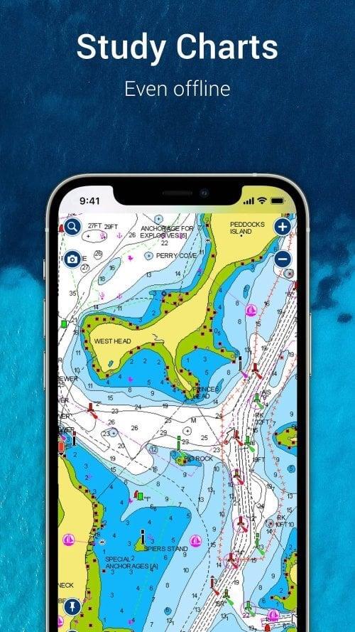
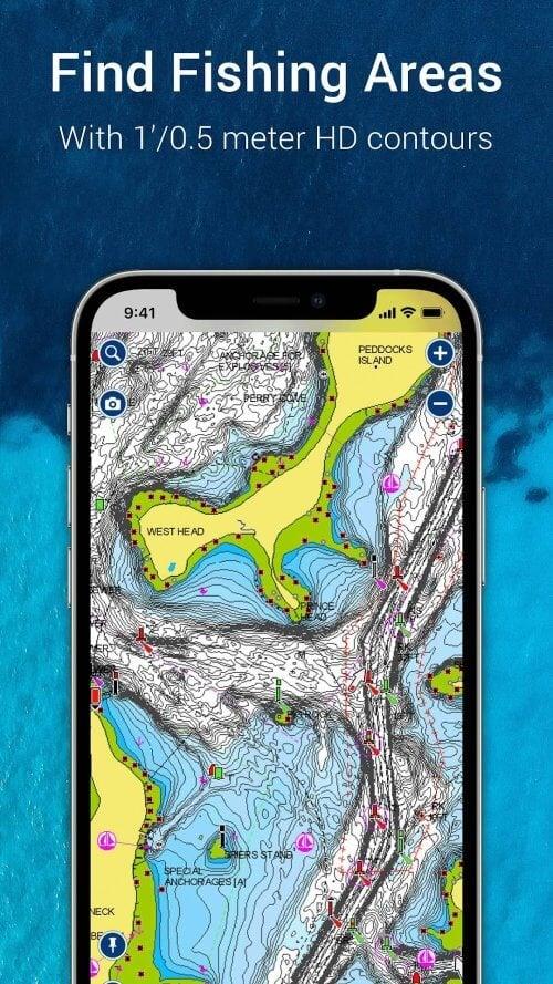
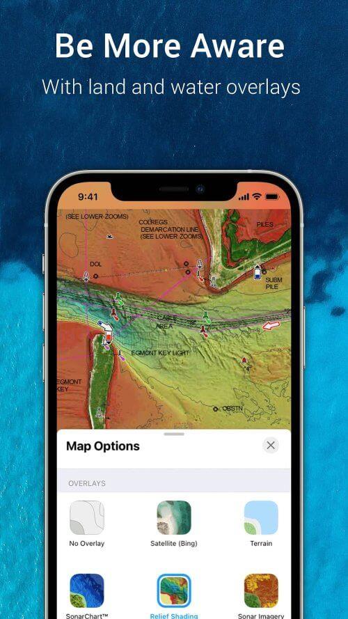
World-class Navionics charts: Dive into reliable and up-to-date Navionics charts, featuring overlays, nautical charts, and SonarChart HD bathymetry maps. These resources are crucial for safe and efficient navigation, providing detailed insights for all your boating needs.
Active and helpful community: Engage with a lively community of fellow boaters who share their local knowledge, highlight attractions, and offer navigation tips. Stay connected with friends by sharing your real-time position, tracks, routes, and markers, fostering a collaborative learning environment among water enthusiasts.
External device-friendly for more features: The app integrates seamlessly with chartplotters, enabling the transfer of routes and markers. Utilize SonarChart Live Mapping to generate real-time maps during your voyages. Connect an AIS receiver via Wi-Fi to monitor nearby maritime traffic and receive alerts about potential collisions, enhancing your situational awareness on the water.
Daily updates: Benefit from daily updates that keep your charts and data current. Stay informed about changes in bottom topography, navigation aids, and maritime services, ensuring your boating experience is both safe and enjoyable.
Conclusion:
Navionics® Boating is a must-have for anyone passionate about boating, angling, or sailing. Its world-class Navionics charts deliver comprehensive and reliable navigation data for both the surface and depths of the sea. The app's thriving community fosters connections, knowledge sharing, and local discovery among users. Compatibility with external devices like chartplotters and AIS receivers offers additional features that enhance your on-water experience. Thanks to daily updates, you're always equipped with the latest information, ensuring your safety and enjoyment. Download Navionics® Boating now and transform your boating adventures into more enjoyable and informed journeys.
17.0.2
248.94M
Android 5.1 or later
it.navionics.singleAppMarineLakesHD